Landscapes
Beauty is all around us in land, sea & air
Before ordering, see shipping instructions
Scenic Solitude - Capturing the Unique Atmosphere
Canada
Ontario
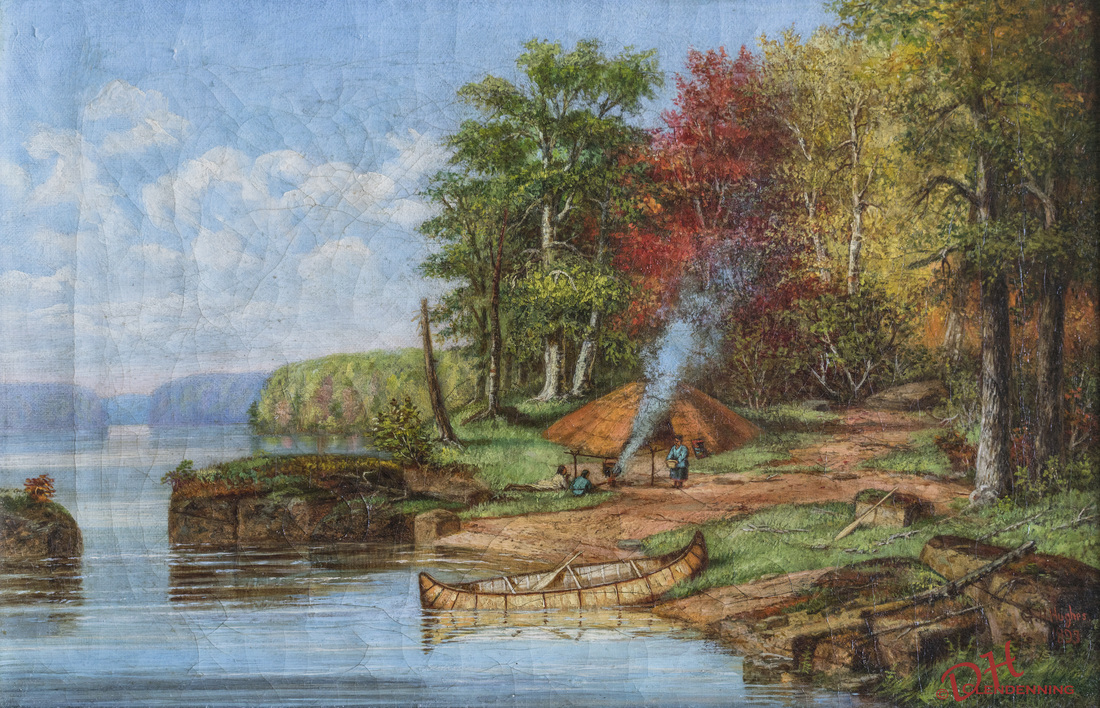
Reprography: Indian Encampment, Upper Ottawa River, G.H. Huges, Painter, 1893, Oil, Private Collection
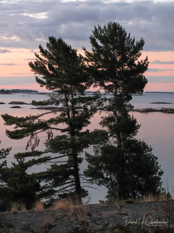
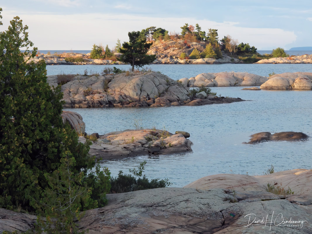
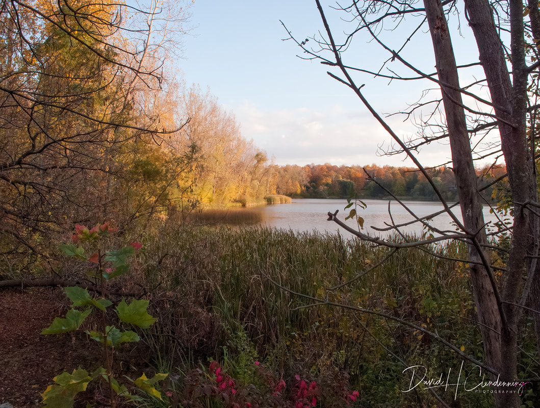
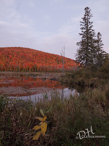
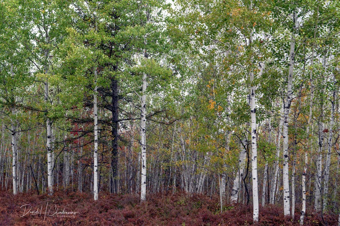
Title: Pines Trees on Georgian Bay at Twilight,
Order No. L3-6450.
|
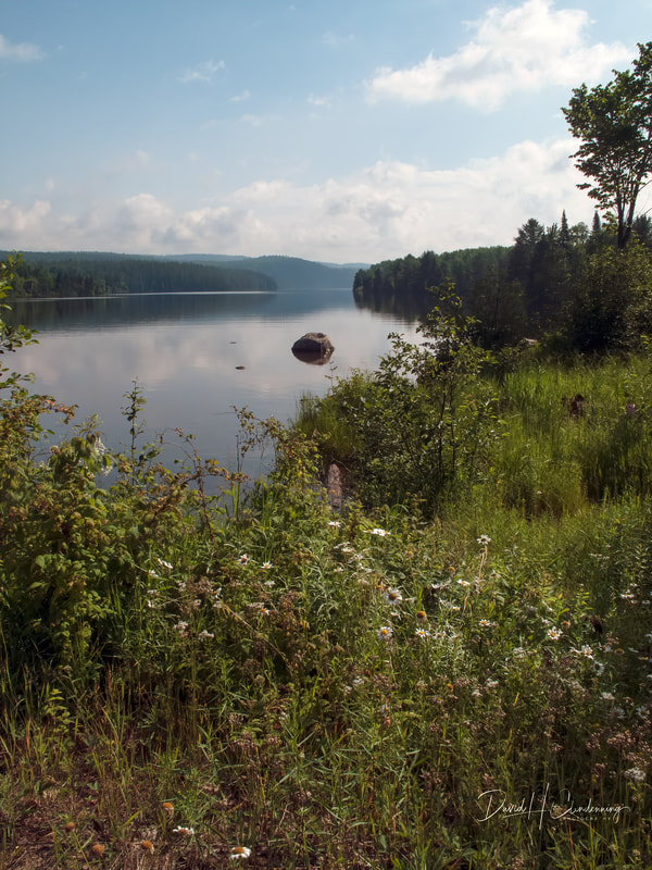
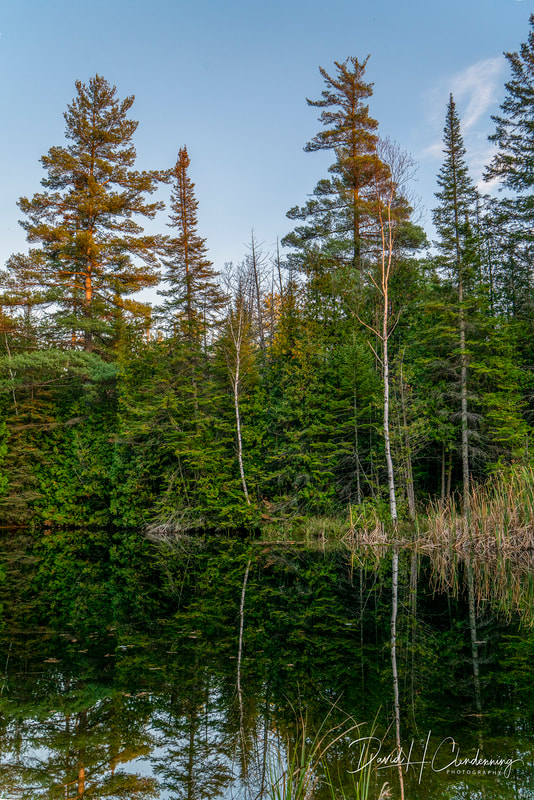
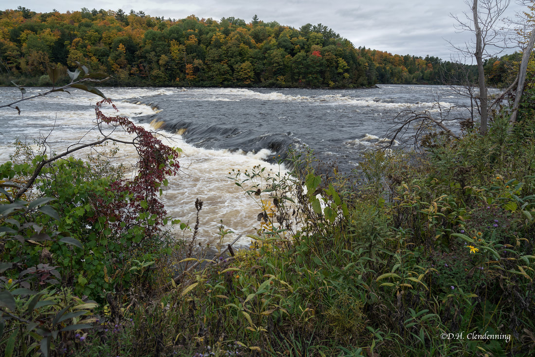
Title: Upper Ottawa River
Order No.: L3-3138.
|

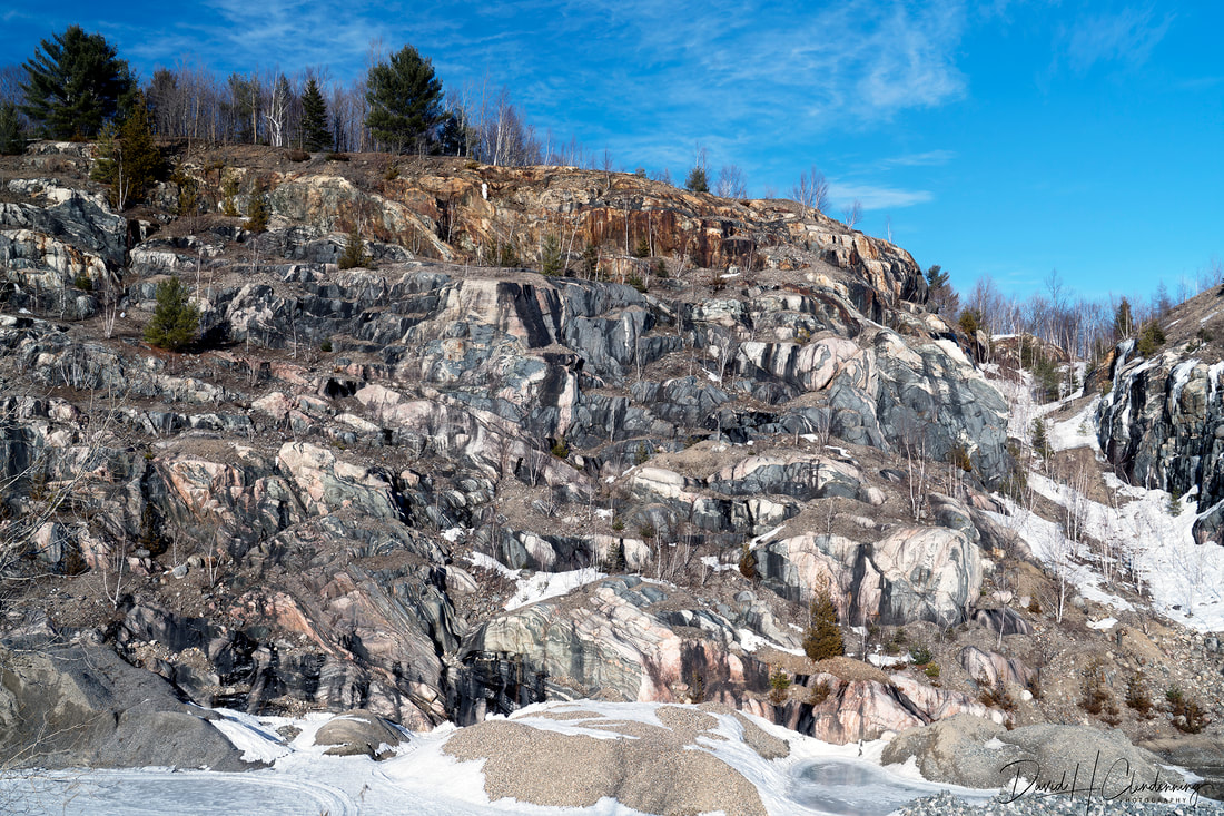
Title: Rocky Terrain.
Order No.: L3-2611.
Location: Killarney Provincial Park, Ontario.
|
Title: The Point, St.Joseph Island.
Order No.: L3-
Location: Northern Ontario.
|
The Last of the Light - About Twilight
Title: Georgian Bay Islands at Twilight,
Order No.: L3-2922.
Country: Canada (Ontario).
|

Title: Before Sunrise #1,
Order No.: L3-2792,
Location: Canada (Ontario)
|
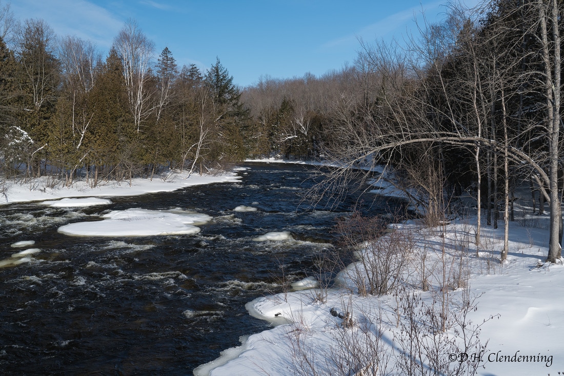
Title: Clyde River near Herron Mills.
Order No.: L3--2376.
Country: Canada (Ontario).
|
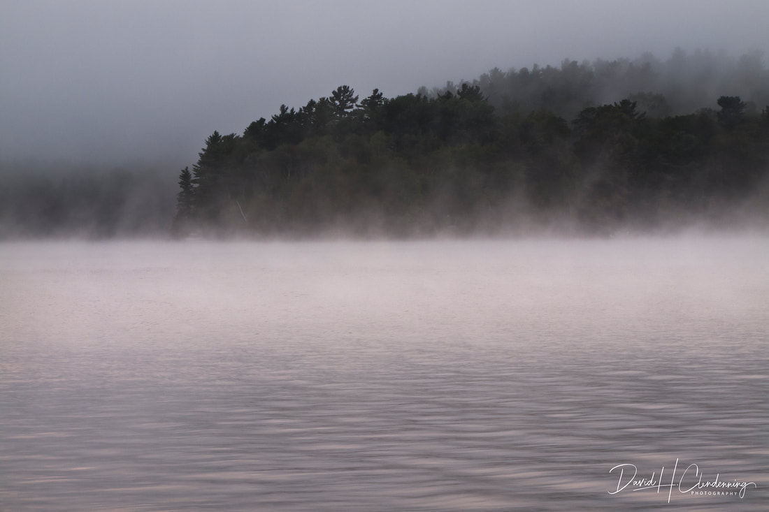
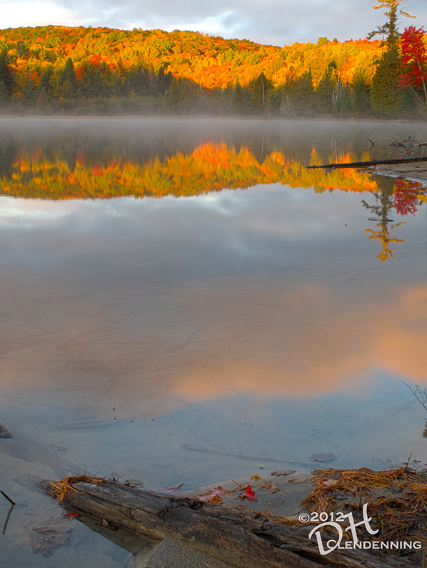
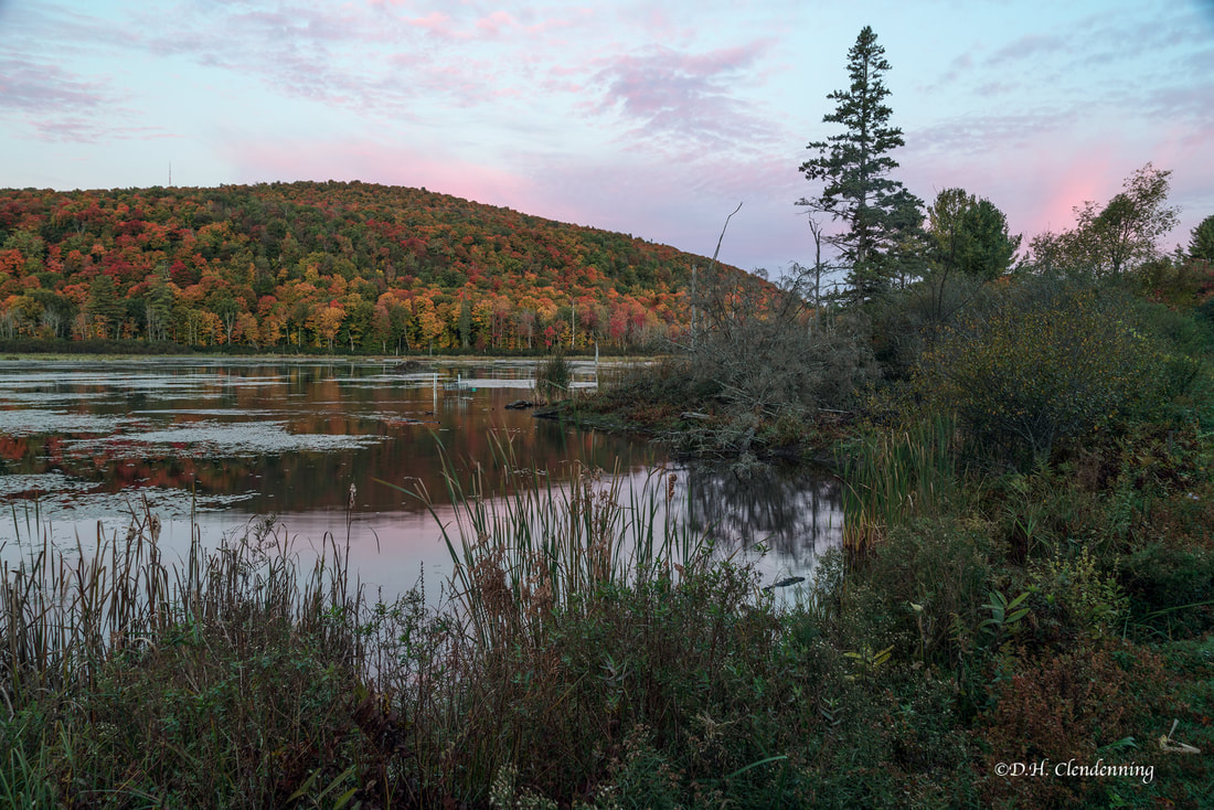
Title: Lake Baptist in Morning Mist,
Order No.: L3-0222.
Country: Canada (Ontario)
|
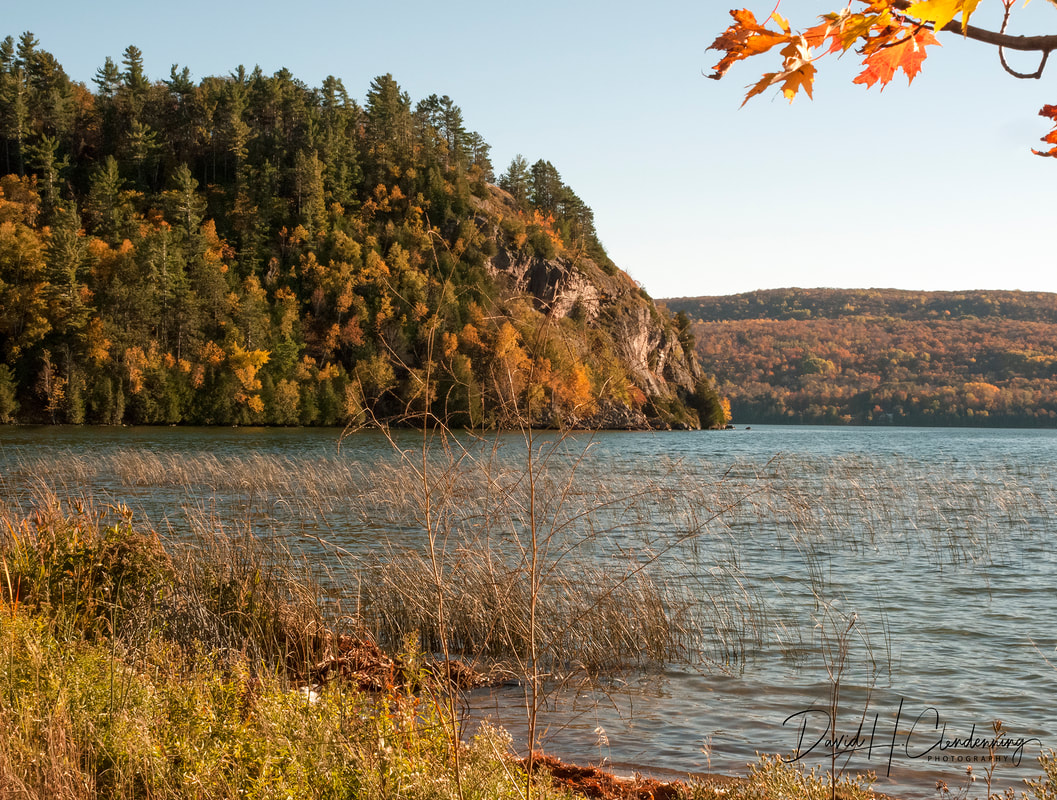
Title: Clear Lake in Early Fall.
Order No.: L2.5806.
Location: Canada (Ontario)
|
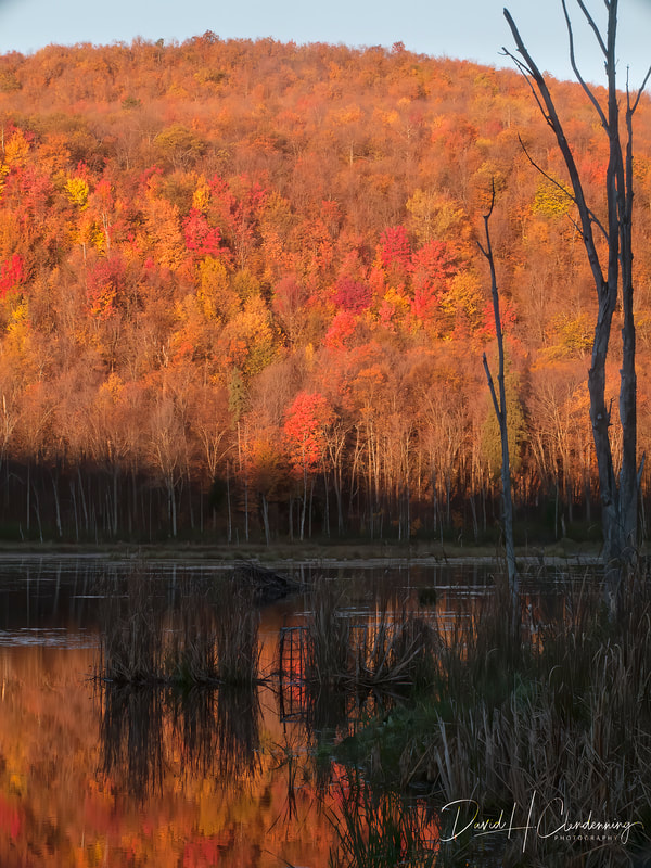
Title: McKay Lake, Early Fall Evening.
Order No.: L3-6545.
Location: Canada (Ottawa, Ontario).
|
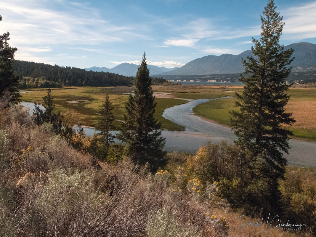
Near Uxbridge, Ontario
Title: The Pond at Lynn's Cabin
Order No.: L2-4234.
Location: Con 3, near Uxbridge, ON. Oct 2021.
Bon Echo Park
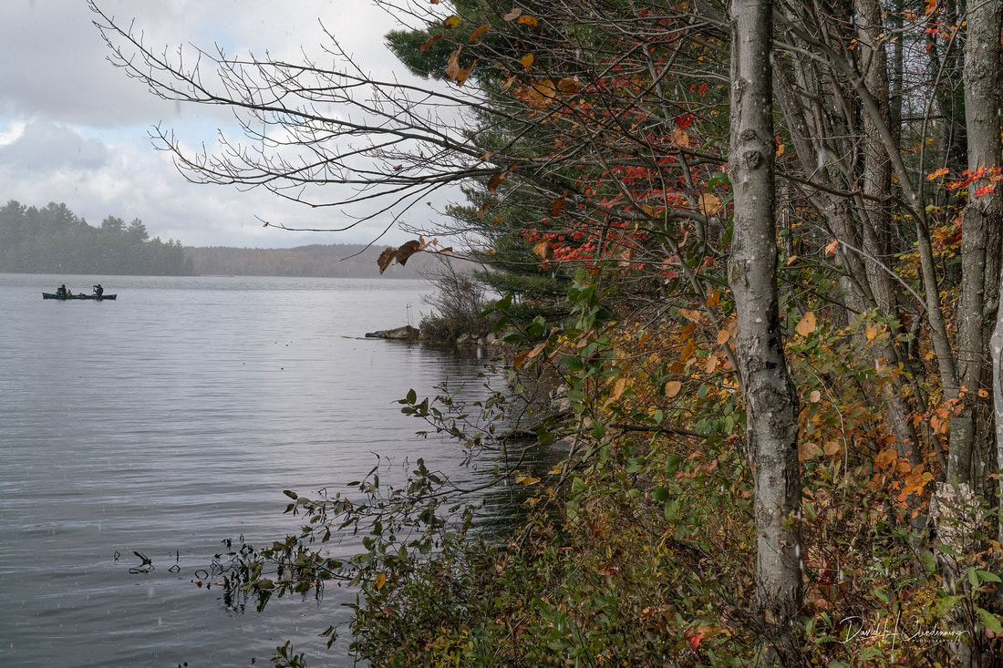
Title: Canoeing on Joeperry Lake before the Storm.
Order No.: L3-3177.
Location: Bon Echo Provincial Park, Ontario.
|
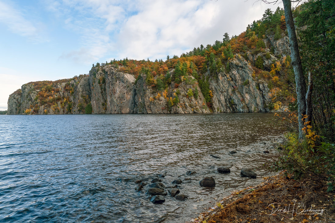
Title Headlands, Bon Echo Provincial Park.
Order No.: L3-3053.
Location: Central Ontario
|
Algonquin Park
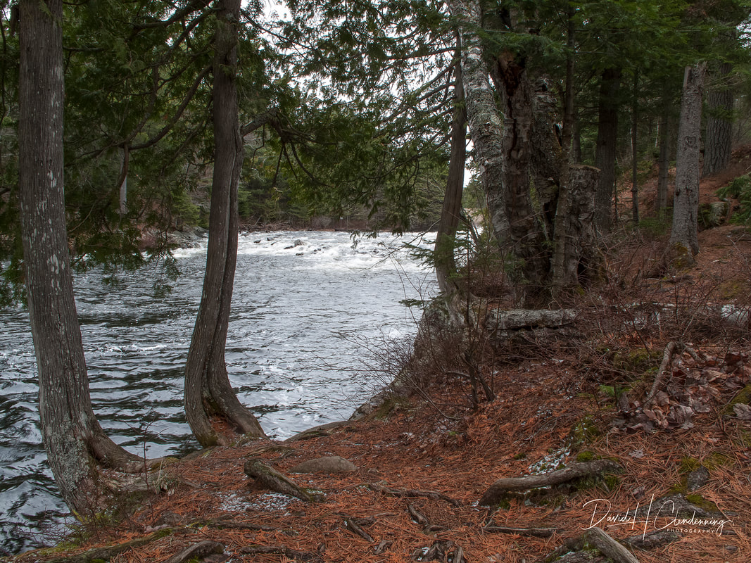
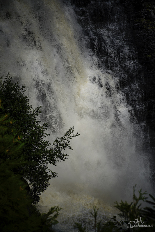
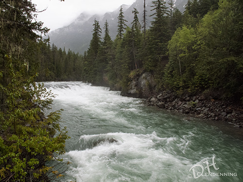
Title: Rushing Spring Water.
Order No.: L3-1517.
Location: Algonquin Park
|

Title: Summer cottage in Spring time.
Order No.: L3-1664.
Location: Algonquin Park, Ontario
|
Ottawa
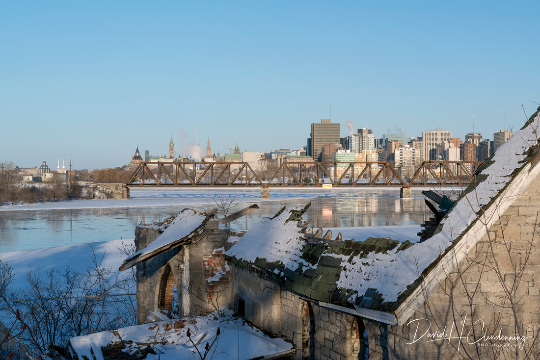
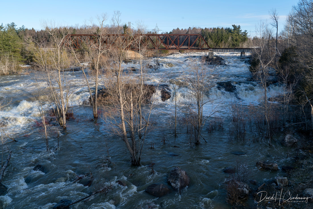
Title: Urban Landscape - Ottawa Railway Bridge. Order No.: L3-6707.
|
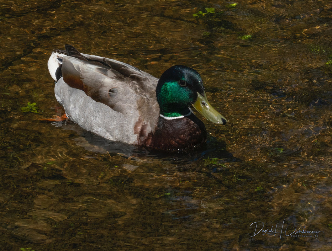
A mallard on the shore of Mudd Lake, Ottawa, May 2022.
|
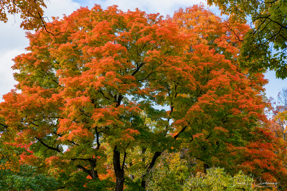
Fall Rhapsody
|
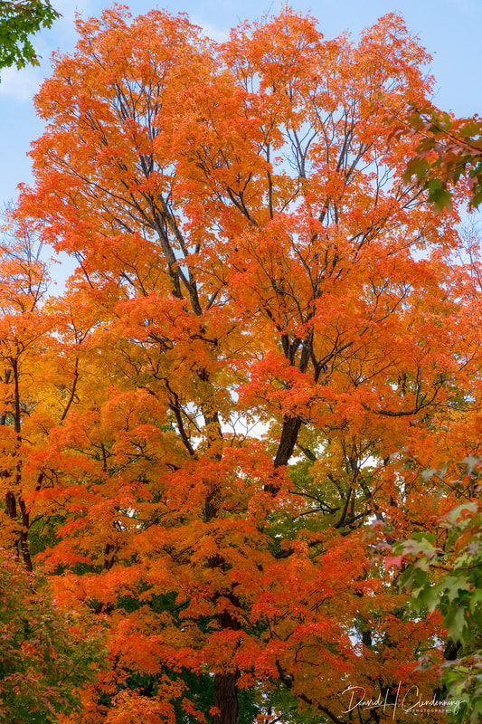
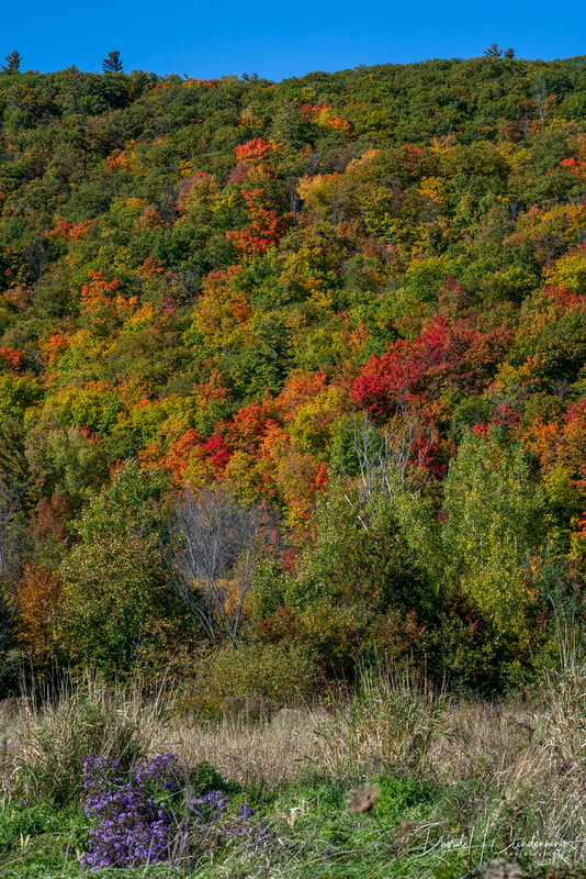
Title: Fall Leaves #2.
Order No.: L3-5678,
Location: Ottawa
|
Canadian Lake Superior & Algoma Regions
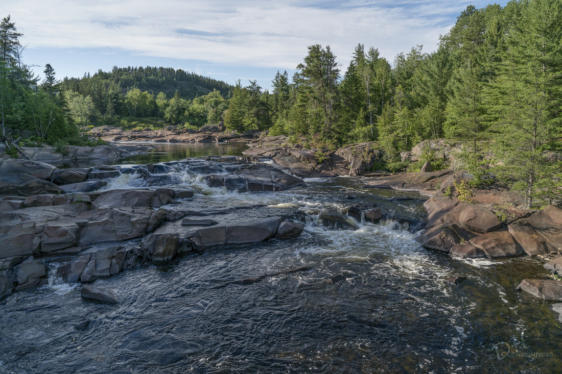
Title: Obabika Falls, ON.
Order No.: L3-2846.
|
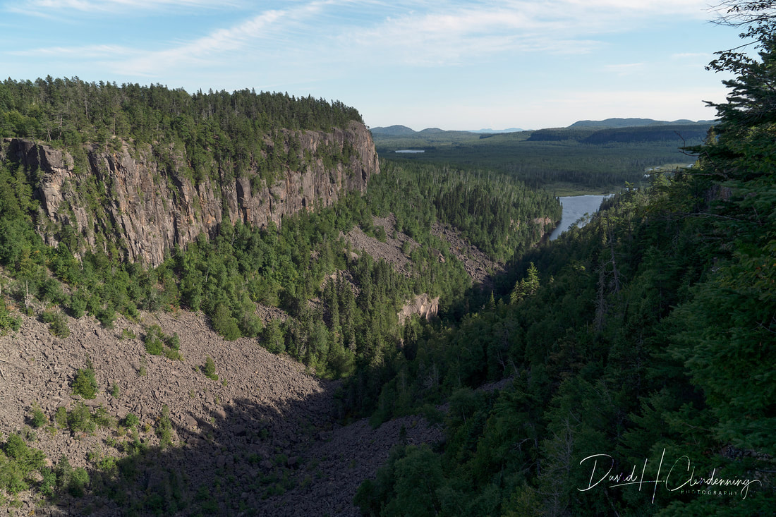
Title: Ouimet Canyon, ON.
Order No.: L3-4282.
|
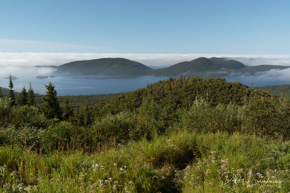
Title: Pic Island, Neys Provincial Park, ON.
Order No: L3-4755
|
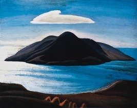
Pic Island was a favourite subject for Lawren Harris, Group of Seven Painter, c.1922-23, (AGO).
|
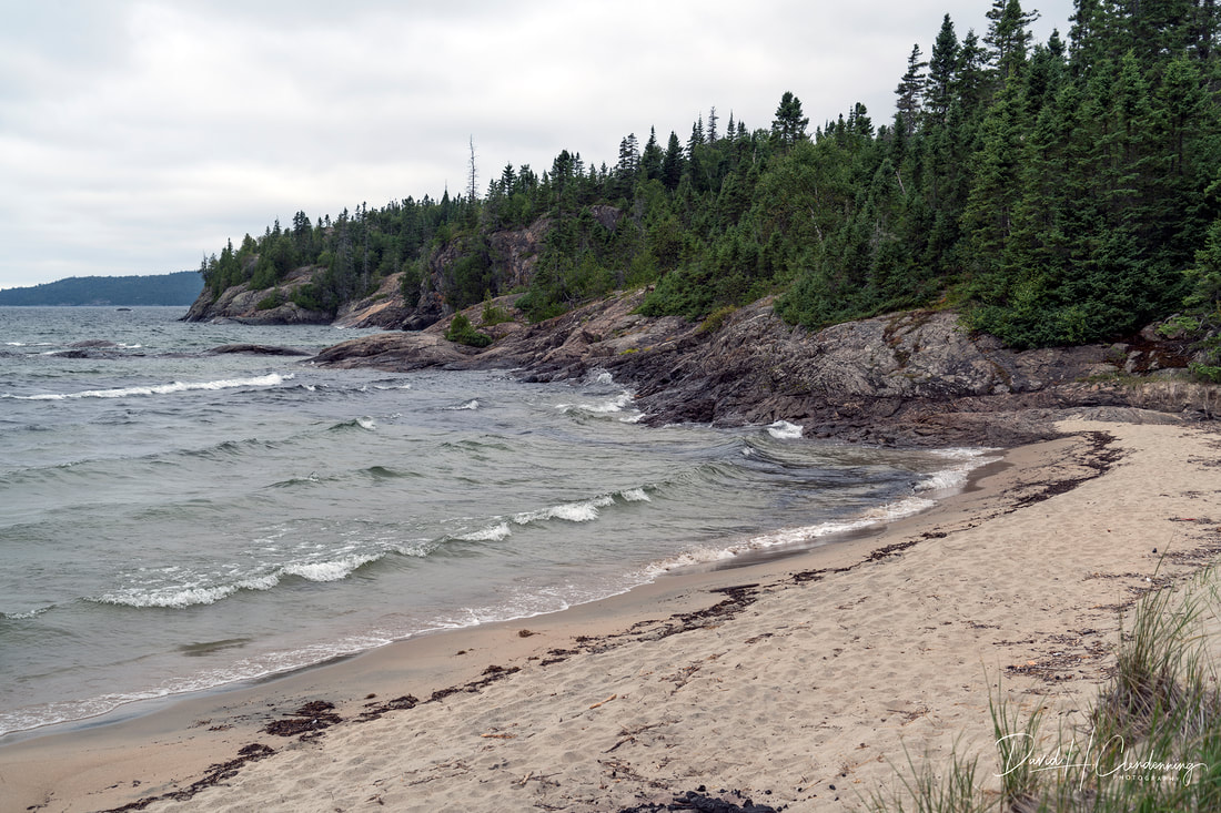
Title: Sandy Beach, Wawa, ON.
Order No.: L3-5413
|
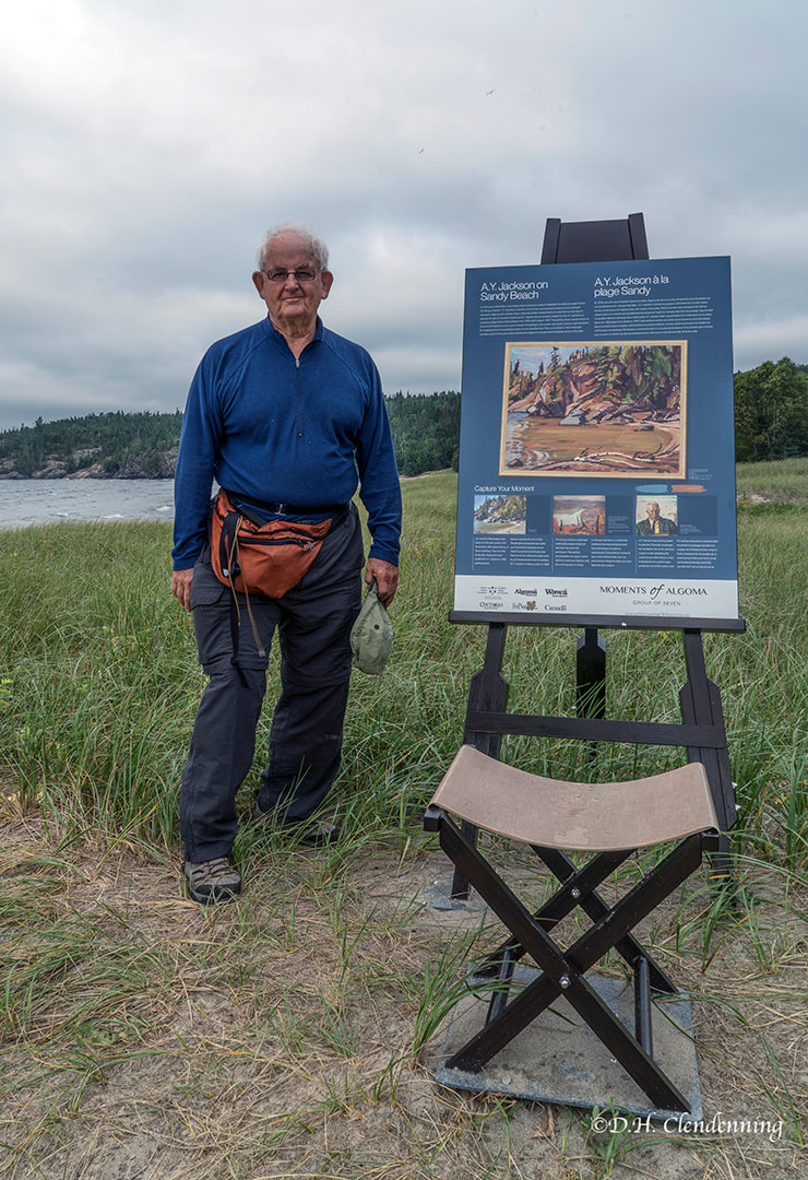
David Clendenning on Sandy Beach, Wawa.
|
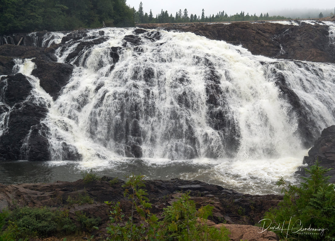
Title: High Falls of the Magpie River, Wawa, ON.
Order No.: L3-5708.
|
Title: Old Women's Bay.
Order No.: L3-5832.
Location: Lake Superior, west side.
|

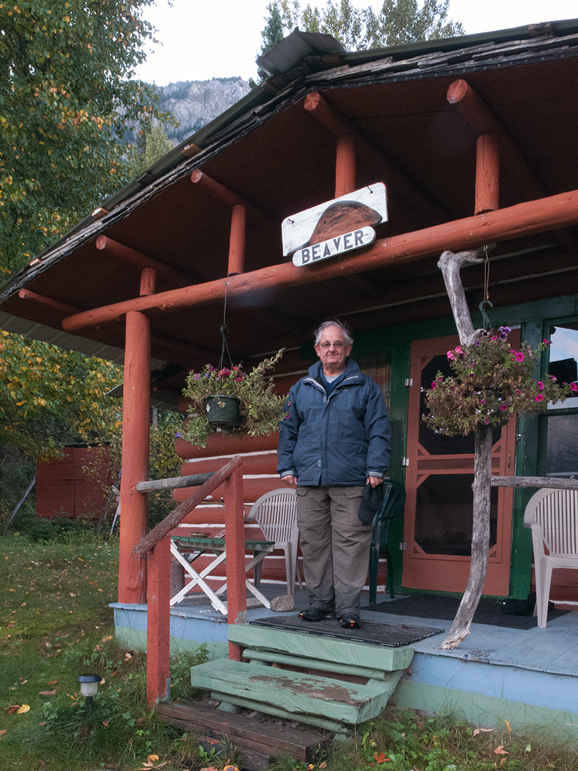
David Clendenning at Young's General Store,Wawa, 2016
|
|
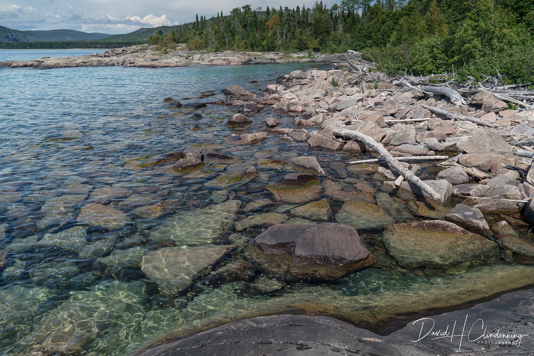
Title: Clearwater.
Order No.: L3-4471.
Location: Ney Provincial Park.
|
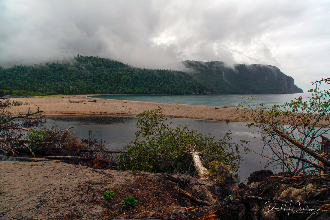
Title: Twilight at Wawa.
Order No.: L3-5250.
Location: Wawa, Lake Superior, Ontario
|
Different views, different lighting conditions, different seasons make for unforgettable landscapes. The shadow is very strong in many photos.
Fur Trading Routes of the 18th-19th centuries
Map showing the main canoe routes of the French, and later the North Western, from Lake Superior to James and Hudson's Bay. For 200 years the Post at Michipicoten stood at the hub' for travel North, East and West. Posts and trail marked...show La Verendryes' journeys (1731-1751) and other early traders, Radisson, DeLhut etc.
Land of the Big Goose, Turcot, Anges, W.

Title: Fur Trading Routes of 18-19th centuries.
Order No.: A1-5772.
Book: Land of the Big Goose, Turcot, Anges, W.
|
Title: Kakabeka Falls on the Kaministiquia River.
Order No.: L3-3961,
|
Map of Journeys and Territory Discovered by Members of the NWCo. and H. B. Co.
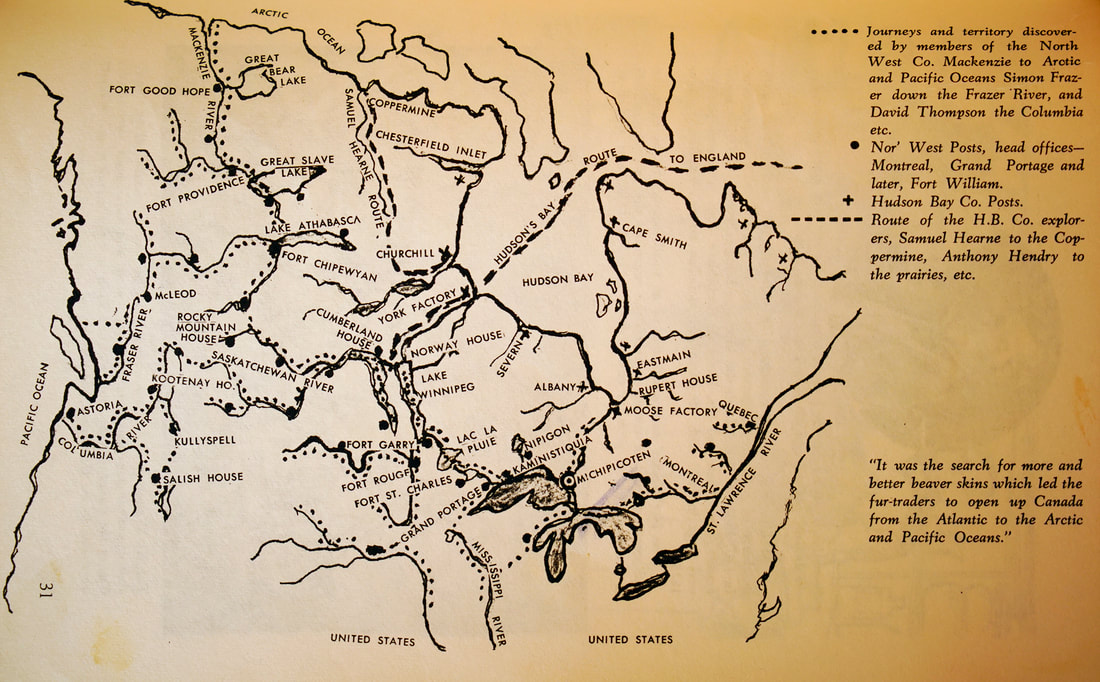
Title: Map of Journeys and Territory Discovered by Members of the NWCo. and H. B. Co.
Order No.: A1-5774.
Book: Land of the Big Goose, Turcot, Anges, W.
|
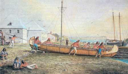
Voyageurs with their Montreal Canoe, Fort William, 1830s.
|
|
Fur Trade Timeline
1753 New France officially becomes British North America. The Treaty of Paris in 1763 ends the Seven Years War (French-Indian War). 1783 The North West Company is officially founded. Britain recognizes the independence of the thirteen American colonies. 1789 Alexander Mackenzie reaches the Arctic Ocean. The French Revolution begins. 1803 NWc0 headquarters is moved from Grand Portage to Fort William. The United States makes the Louisiana Purchase. 1812 United States declares war on Great Britain. The Treaty of Ghent (1814) will define the Canada-US boundary. 1821 The HBC and the NWC0 amalgamate. Parliament grants the new Hudson's Bay Company a fur trading monopoly over 3 million square miles of North America. 1867 The colonies of Nova Scotia, New Brunswick, Quebec and Ontario unite to form the Dominion of Canada. The United States buy Alaska from the Russians. 1959 The St. Lawrence Seaway is officially opened by Queen Elizabeth and President Eisenhower. 1972 The Government of Ontario reconstructs Fort William nine miles up-river from the original site. The cities of Fort William and Port Arthur joined to from Thunder Bay (1970). |
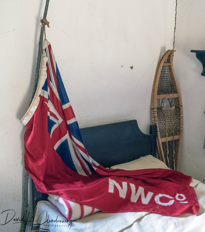
Title: Red Ensign of the NWCo.
Order No.: A1-4166.
Location: Fort Willliam NH Site.
|
Fort William reconstructed in 1939 as it was first built in 1803

Title: Storage area for canoes.
Order No.: A1-4142.
Location: Fort William (reconstruction 1939).
|
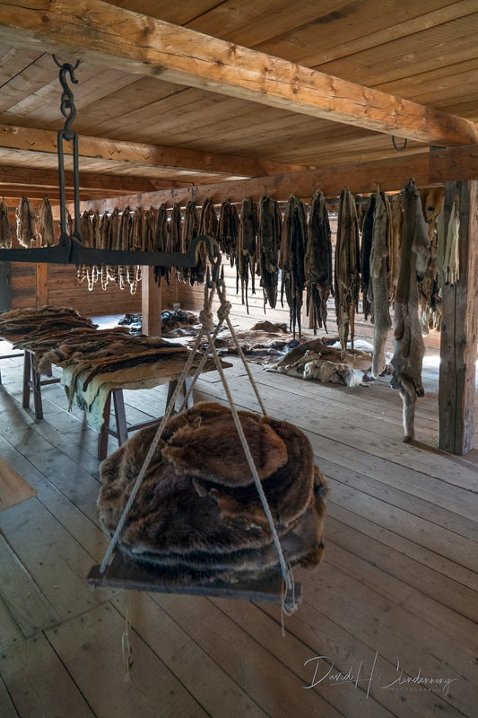
Title: Scales for fur grading and weighing.
Order No.: A1-4135.
Location: Fort William (reconstruction 1939).
|
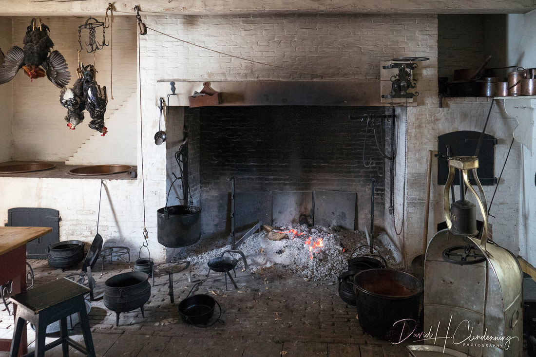
Title: Kitchen in Main House.
Order No.: A1-4180.
Location: Fort William National Historical Site, (reconstruction, 1939).
|
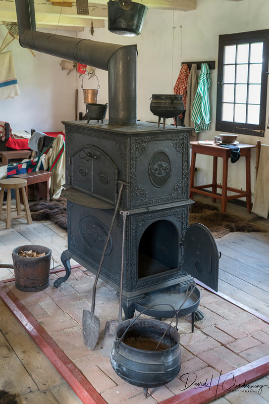
Title: Double Stove by Forge St. Maurice, Quebec.
Order No.: A1-4161.
Location: Fort Willian NH Site.
|
Quebec
|
Title: Fall in the Gatineau Hills, Quebec, 2019
Order No.: L3-2651
|
David Clendenning, Oct 14, 2019, Ottawa
|
Title: Fall in the Gatineau Hills.
Order No.: L3-4860.
Location: Canada (Quebec).
|
Title: Kelly Lake, Gatineau Hills,
Order No.: L3-3719
Country: Canada (Quebec)
|

Title: 'Fall Rhapsody' in Gatineau Hills,
Order No.: L3-3900,
Country: Canada (Quebec)
|
Title: Gatineau Hills in Autumn,
Order No.: L3-0724,
Country: Canada (Quebec)
|
Title: Gatineau Hills Escarpment in Fall. Order No.: L3-5660.
Location: Off the Luskville Road, QC, near Ottawa.
Title: Early Spring
Order No.: L3-2808.
Location: Gatineau, QC
|

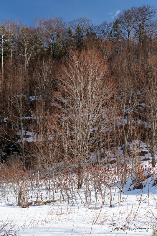
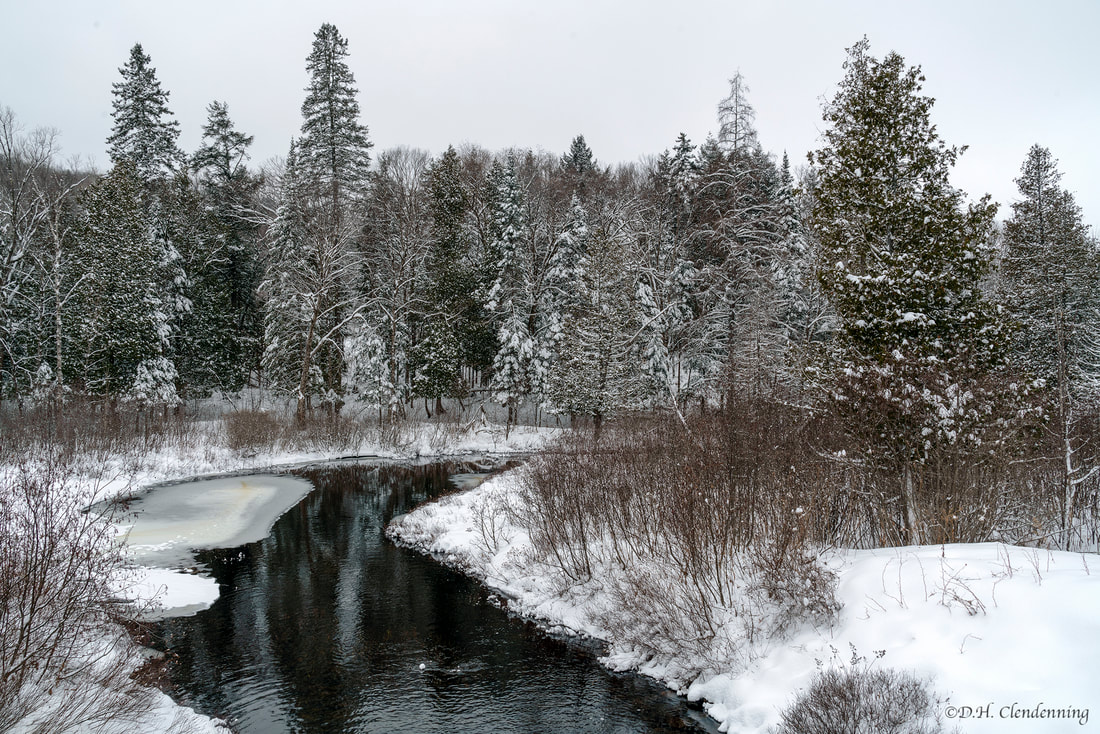
Title: Meandering Stream in Winter.
Order No.: L3-3200.
Location: Gatineau Park, Quebec.
|
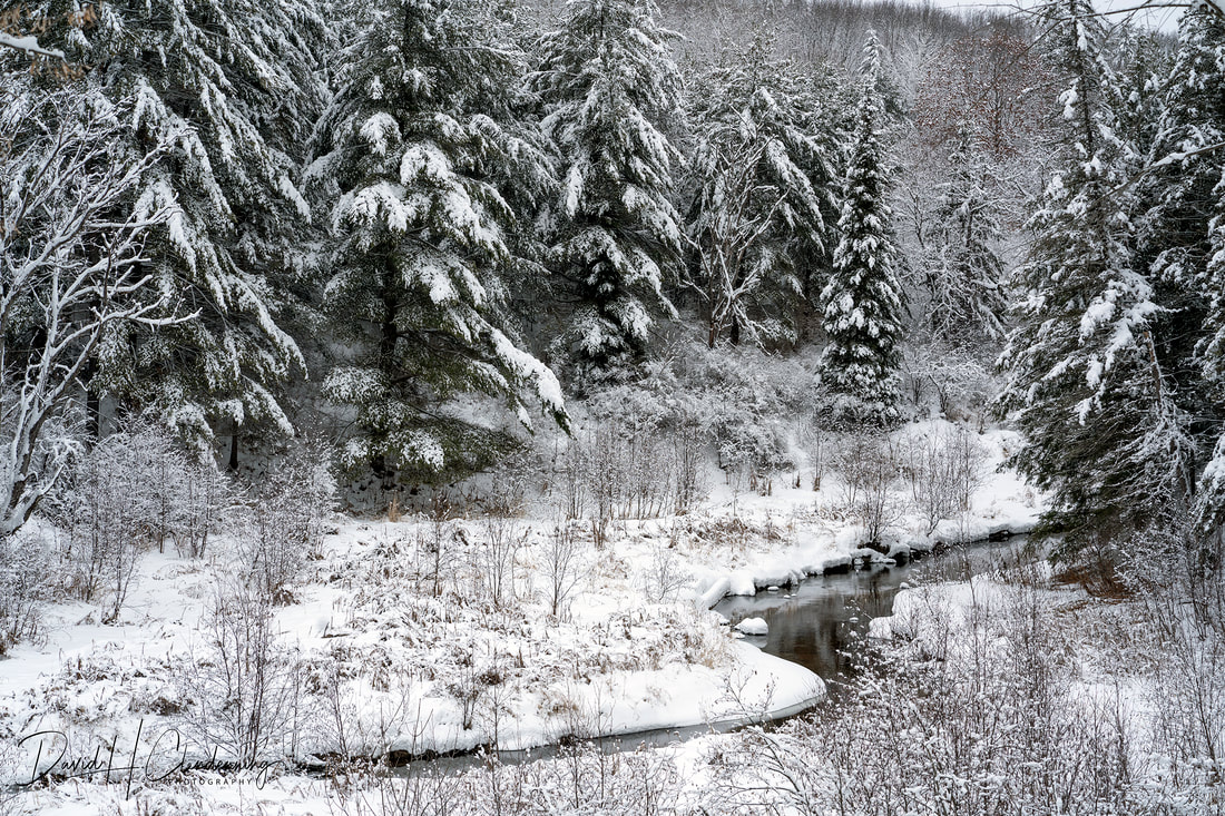
Title: View of Winding Stream in Winter.
Order No.: L3-3195.
Location: Gatineau Park, Quebec.
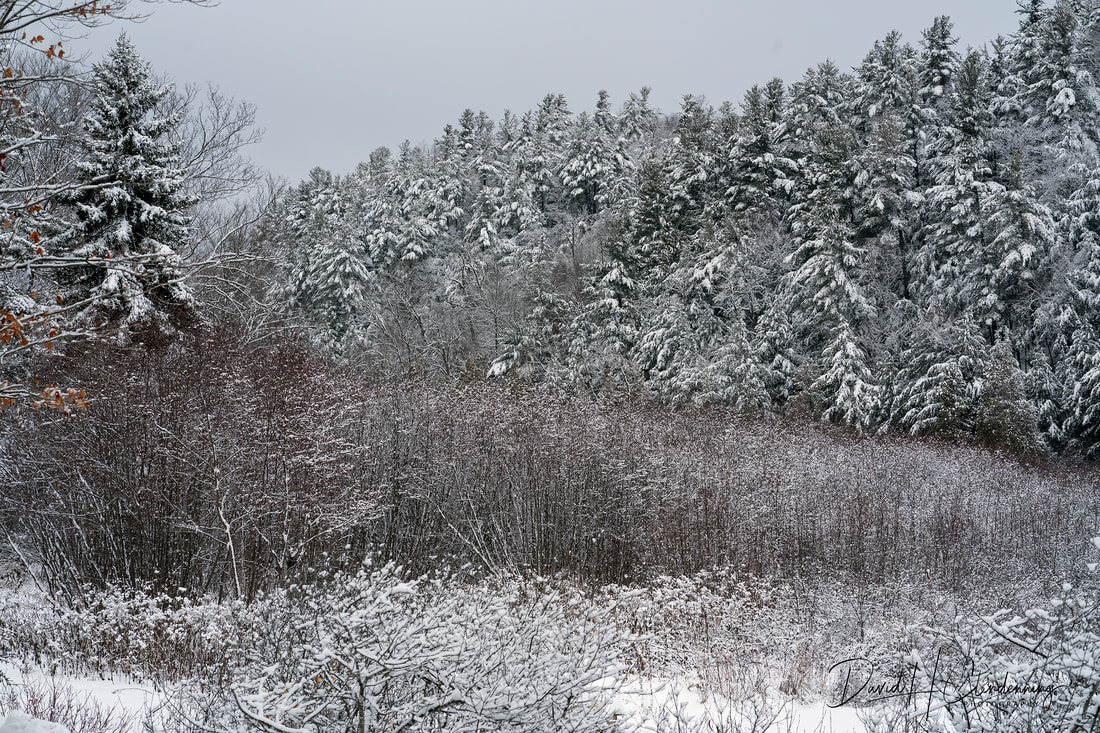
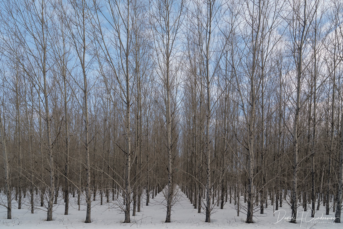
Title: Forest in Winter.
Order No.: L3-3192.
Location: Gatineau Park near Meach Lake.
|
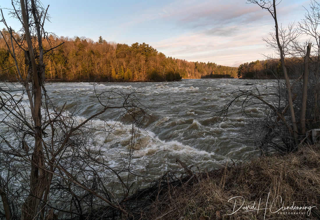
Title: Gatineau Spring Rapids.
Order No.: L3-9014.
Location: Gatineau River, Quebec
|
Gatineau River in the Fall.
Order No.: L3-8080.
Location: Gatineau, QC
|
Title: Spring Runoff, du Lievre River.
Order No.: L3-9648.
Location: Masson, Quebec.
|
Title: Lake in Gatineau Hills,
Order No.: L3-7902.
Location: Gatineau Park.
|
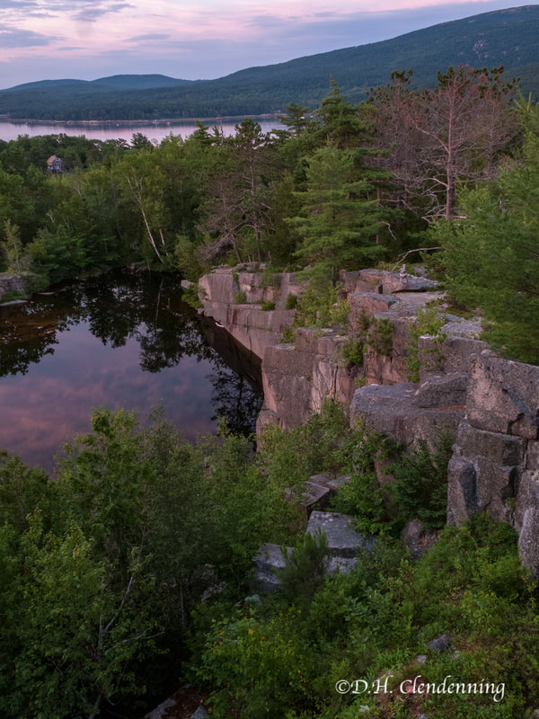
Title: Abandon Cantley Quarry.
Order No.: L3-7988,
|
Title: Stream flowing into Lac Daro Sud.
Order No.: L3-9569.
Location: Papineau region, QC
|
Title: View of Lac Simon
Order No.: L3-9575.
Location: South of Duhamel, QC.
|
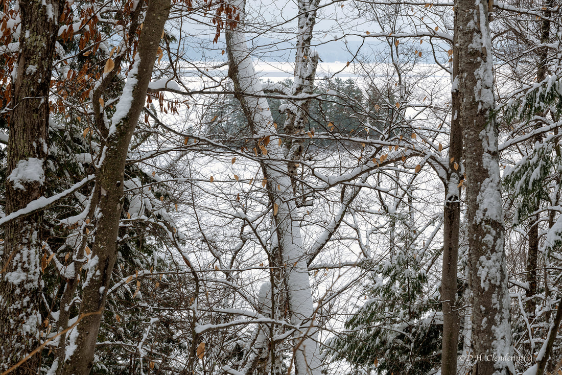
Title: Trees in Winter.
Order No.: L3-2752.
Location: Cantley, QC
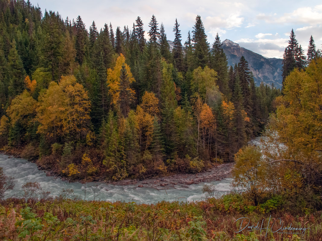
Luskville, La Peche, Gatineau Hills route, Fall 2021

_DSC4176
Hiking Trail to Eardley Escarpment.
Order No.: L3-4176.
Location: Gatineau Hills near Luskville, QC.
|
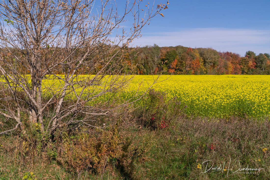
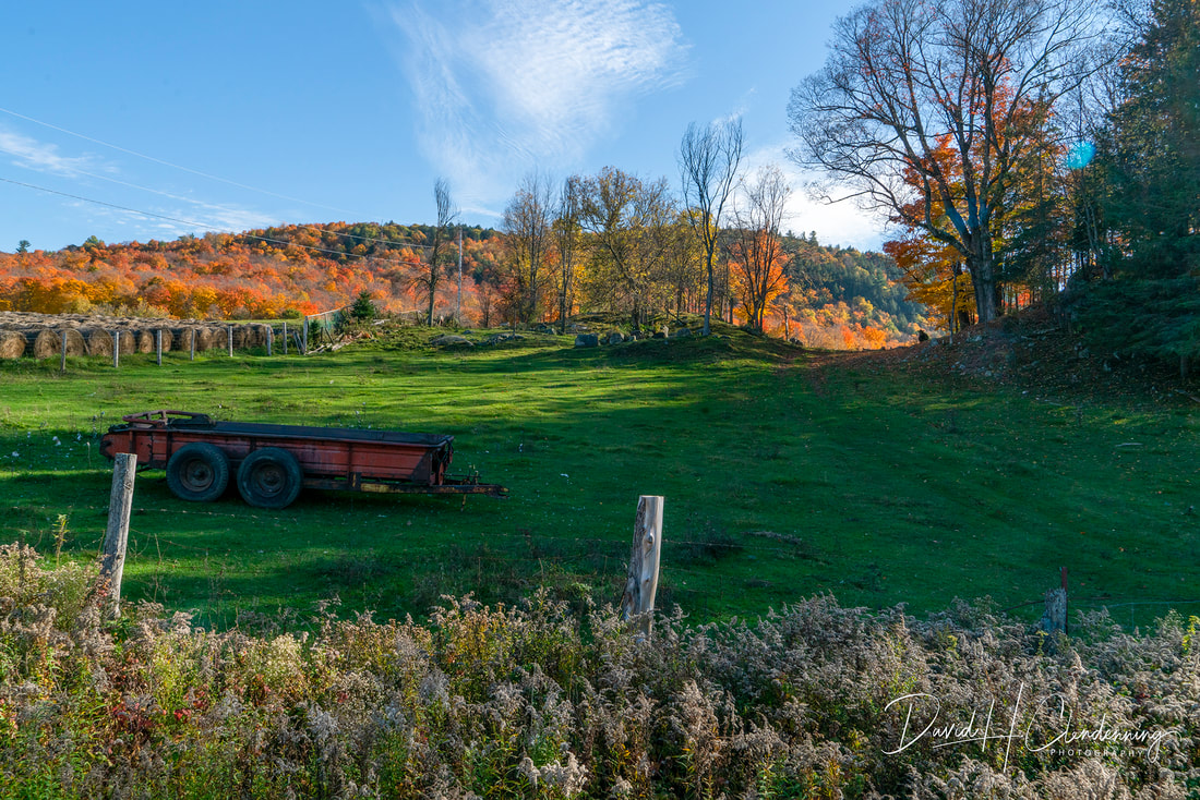
Title: Farmer's Field in Fall.
Order No.: L3-4190.
Location: Near Luskville, QC
, Oct 12, 2021, denoise, copy 2
|
Title: Farmer's Field in Fall
Order No.: L3-4197.
Location: Near La Peche, Gatineau Hills.
|

Title: Lac Phillippe in Autumn.
Order No.: L3-4207.
Location: Gatineau Park, QC.
|
Montmorency Falls, near Quebec City
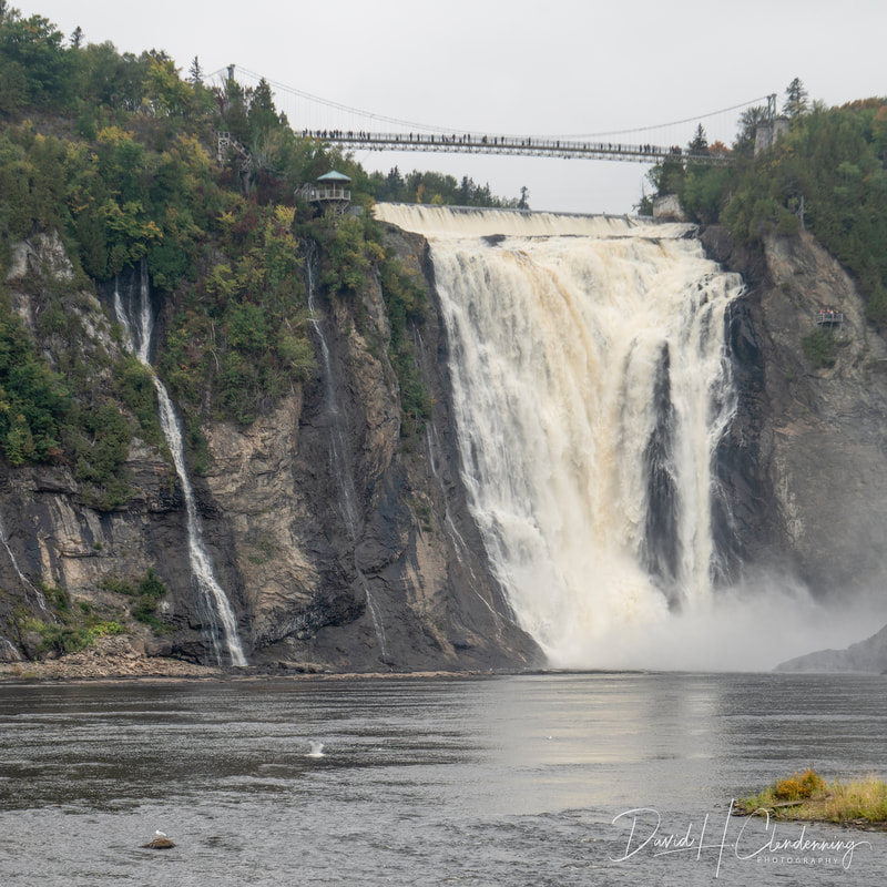
Title: Montmorency Falls and Suspension bridge on the Montmorency River.
Order No.: A1-4164.
Location: near Quebec City.
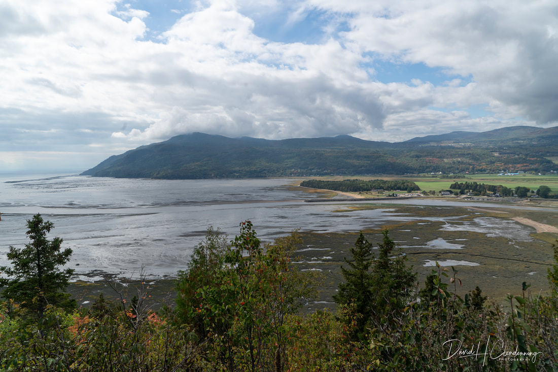
Title: View of old Quai and Beach at Baie-Saint-Paul.
Order No.: A1-4066.
Location: Charlevoix region.
Parc national des Grands Jardins, Charlevoix region
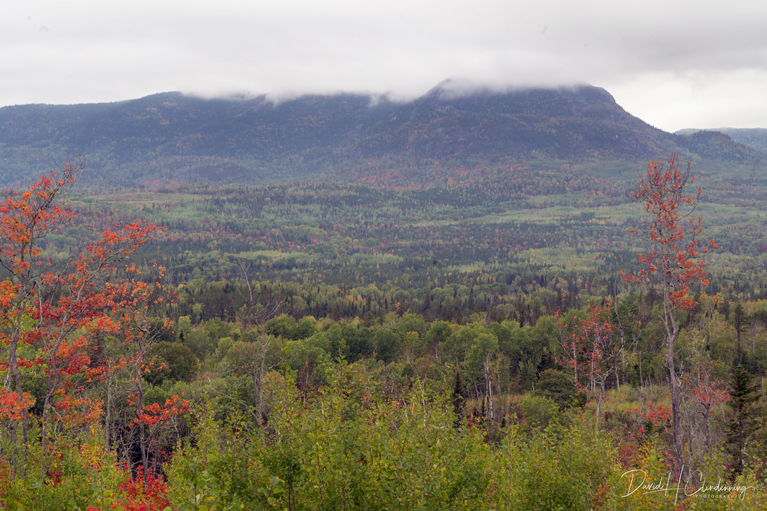
View towards Parc national des Grands Jardins.
Order No.: A1-4131.
Location: Charlevoix
|
Title: Grove of Birtch Trees.
Order No.: A1-4137.
Location: near Mont de Lac Des Cyges. Charlevoix.
|
Parc national des Hautes Gorges de la Riviere Malbaie
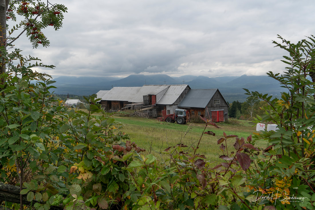
_DSC4095 Farm and Church at Notre-Dame-des-Monts, Parc national des Hautes Gorges de la Riviere Malbaie in background.

Title: View towards Parc national des Grands-Jardins.
Order No. A1-4101.
Location: Charlevoix
|
4109
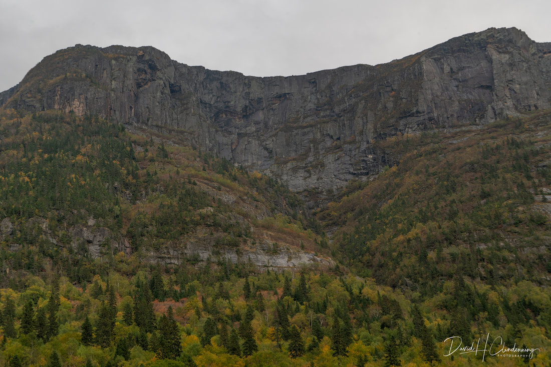
Title: Mont Eudore-Fortin.
Order No. A1-4109.
Location: Parc national des Grand-Jardins.
|
New Brunswick

Title: Estuary, Tides In.
Order No.: L3-0606.
Location: Funday National Park, NB.
Alberta & British Columbia
Livingstone Range - Southern Alberta
Title: View of Livingstone Range.
Order No.: L3-9975.
Location: Southern Alberta
Kooteney Provinceal Park, British Columbia
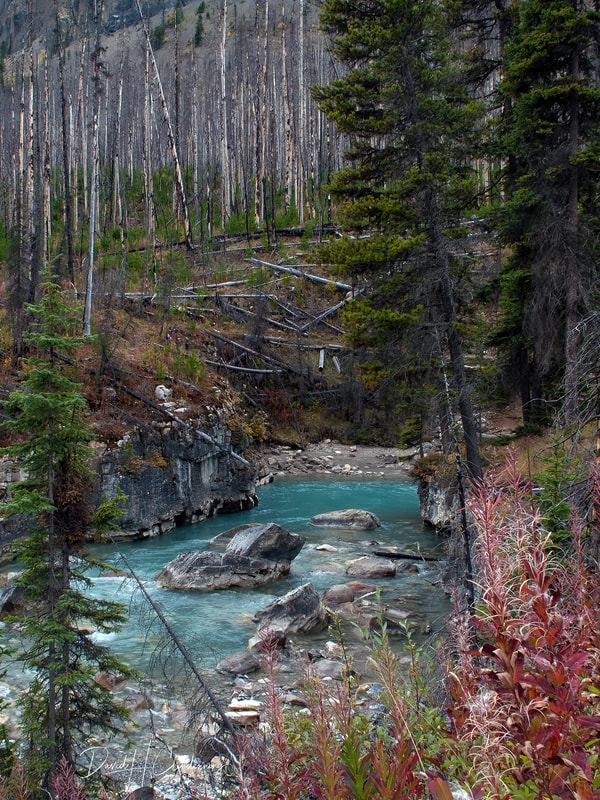
Title: 'Migrating Waters',
Order No.: L3-5024,
Country: Canada, (Canadian Rockies)
|
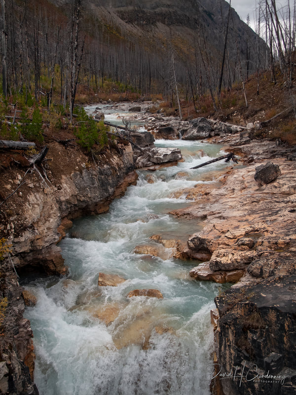
Title: Burnt Forest by Rushing Water,
Order No.: L3-4907,
Country: Canada (Canadian Rockies)
|
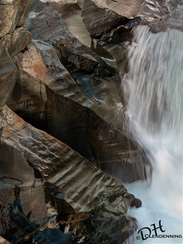
Title: Canyon Falls,
Order No.: L3-5103,
Location: Canada (Canadian Rockies)

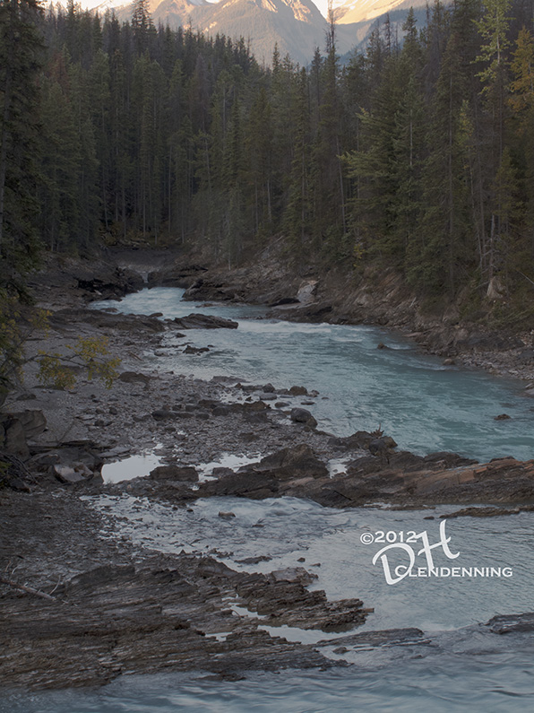
Title: View of Mount Steven.
Order No.: L3-3896.
Location: Yoho National Park.
|
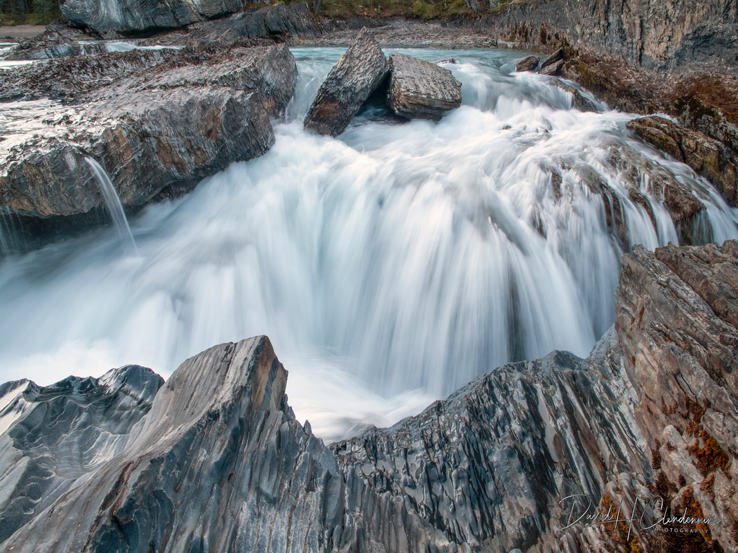
Title: Waterfall in Yoho,
Order No.: L3-3750,
Country: Canada (Canadian Rockies)
|
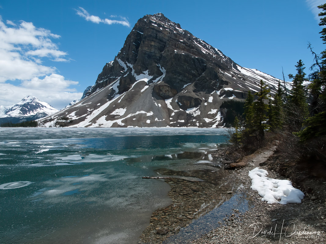
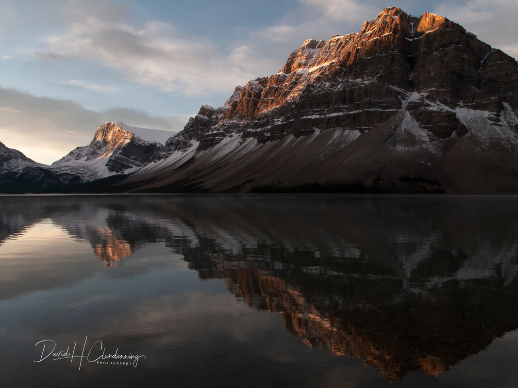
Title: Melting Ice on Bow Lake.
Order No.: L3-0704.
Location: Alberta, Canada.
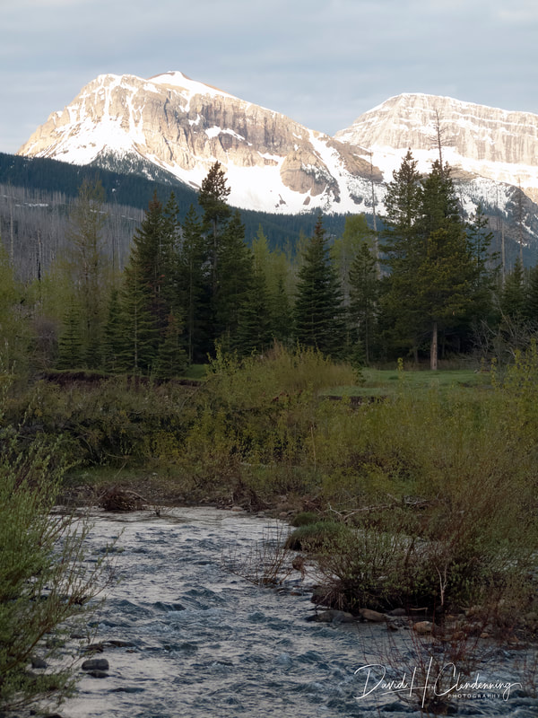
Mount Robson and its River Basin

Title: View of Mt. Robson from Prince of Wales Camp.
Order No.: L3-6297.
Location: Mt. Robson Prov. Park.

Title: Mount Robson.
Order No.: L3-6889.
Location: Mt. Robson Prov. Park
|

Title: View of Mount Robson.
Order No.: L3-6096.
Location: Mt. Robson Prov. Park.
|
Title: Robson River Flowing to the Pacific.
Order No.: L3-6052.
Location: Mt. Robson Prov. Park.
|

Title: Fraser River Flowing to the Pacific.
Order No.: L3-6135.
Location: Mt. Robson Prov. Park.
|
The Robson River owes its milky colour to rock flour: tiny particles scraped from the bedrock by stones embedded in moving glacial ice.
Most Robson's four glaciers supply meltwater to the river, as do the eight other glaciers in the watershed. All this water goes into the Fraser River. There are no lakes along the Fraser in which rock flour can settle out, so it travels all the way to the Pacific Ocean near Vancouver, a journey of a thousand kilometres. The great delta that makes up most of B.C.'s Lower Mainland holds enormous quantities of rock flour from the mountains upstream. A bit of Mount Robson is spread through the soil of farms from Richmond to White Rock, and from Delta to Chilliwack.
Most Robson's four glaciers supply meltwater to the river, as do the eight other glaciers in the watershed. All this water goes into the Fraser River. There are no lakes along the Fraser in which rock flour can settle out, so it travels all the way to the Pacific Ocean near Vancouver, a journey of a thousand kilometres. The great delta that makes up most of B.C.'s Lower Mainland holds enormous quantities of rock flour from the mountains upstream. A bit of Mount Robson is spread through the soil of farms from Richmond to White Rock, and from Delta to Chilliwack.
David Clendenning stayed at the historic Prince of Wales Camp, circa, 1930s.
Location: Mt. Robson Provincial Park, 2011.
|

David Clendenning on a very early morning walk, 2011.
|
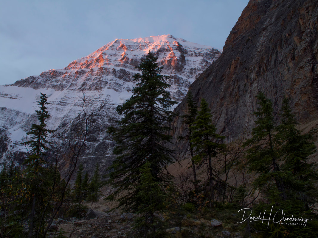
Title: Mount Edith Cavell.
Order No.: L3-6713.
Location: Jasper National Park
|
Title: Mount Edith Cavell,
Order No.: L3-6710
Country: Canada (Canadian Rockies)
|
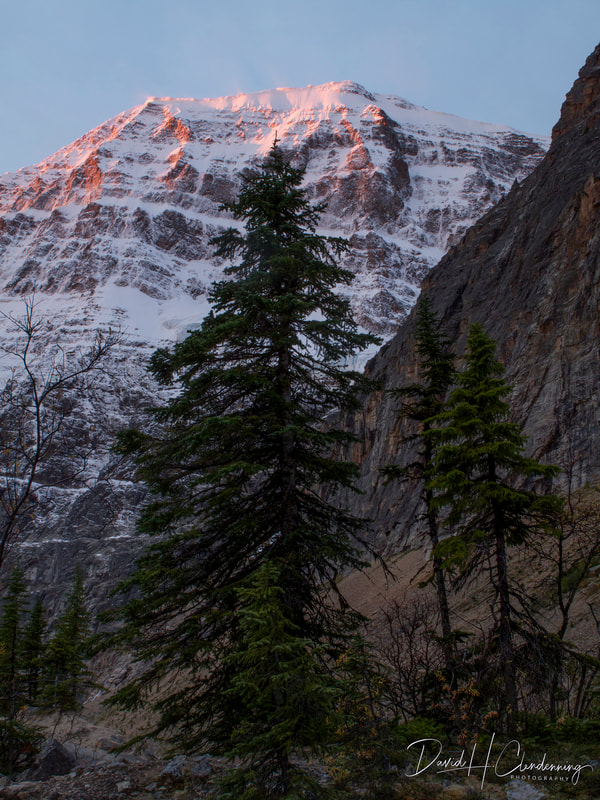
Title: "Creation" - Bow Lake,
Order No.: L3-4186,
Country: Jasper National Park,(Canadian Rockies)
|
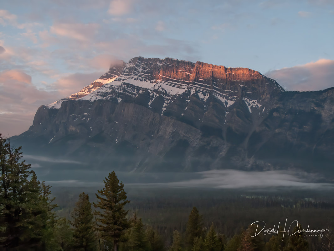
Title: Mount Rundle.
Order No.: L3-0366.
Location: Banff National Park, Alberta.
|
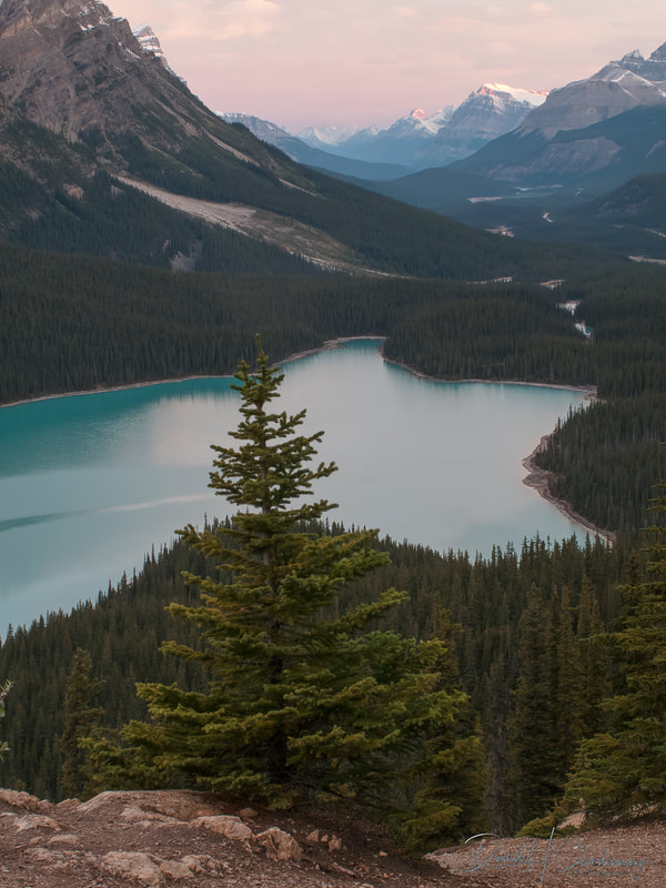
Title: Lake Peyto in early morning.
Order No.: L3-4157.
Location: Banff National Park.
|
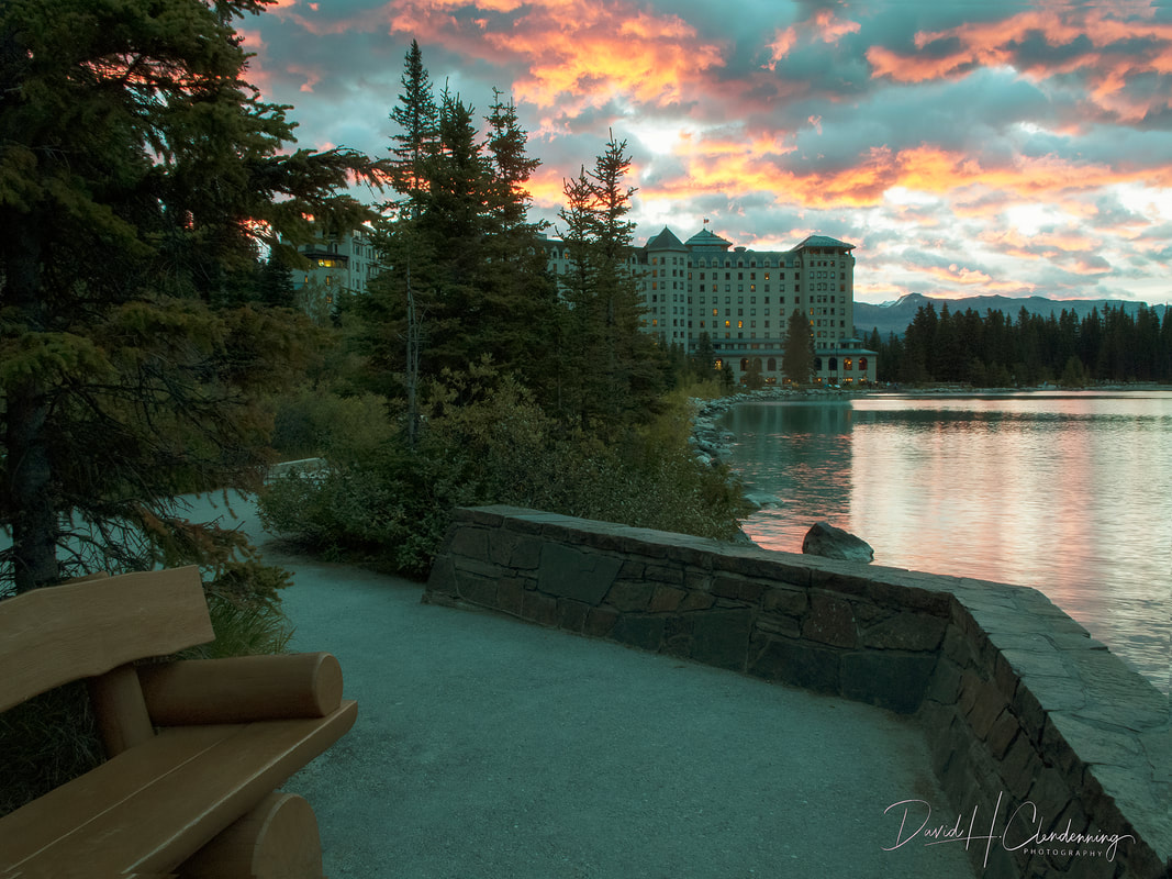
Title: On an early morning walk to Chateau Lake Louise.
Order No.: A1-4697.
Location: Banff National Park.
|
Title: Early Morning in Yoho,
Order No.: L3-37112,
|
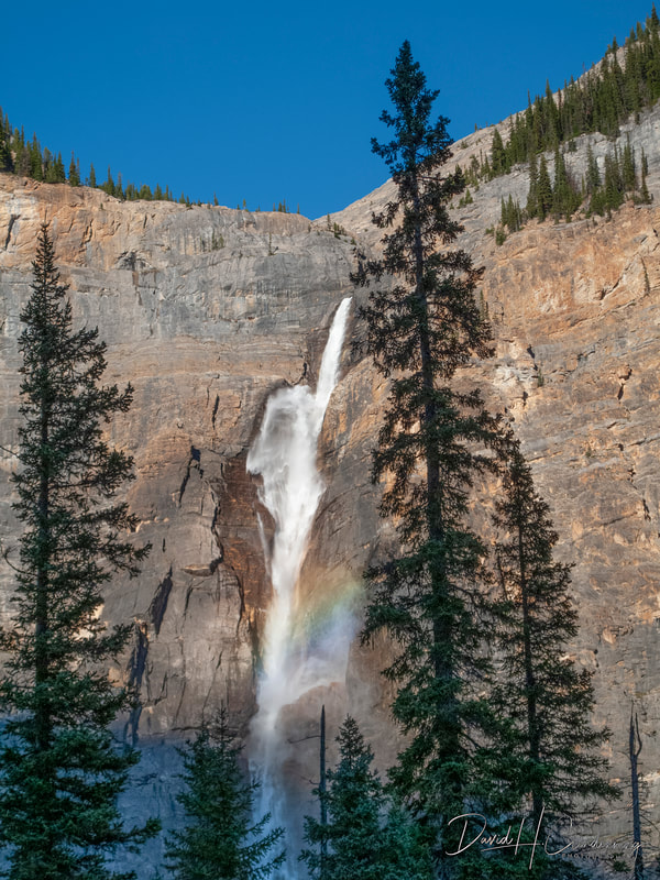
Title: Takakkaw Falls.
Order No.: L3-3934.
Location: Yoho National Park.
|

Title: Clouds over Mt. Robson,
Order No.: L3-6120,
Country: Canada (Canadian Rockies)
|
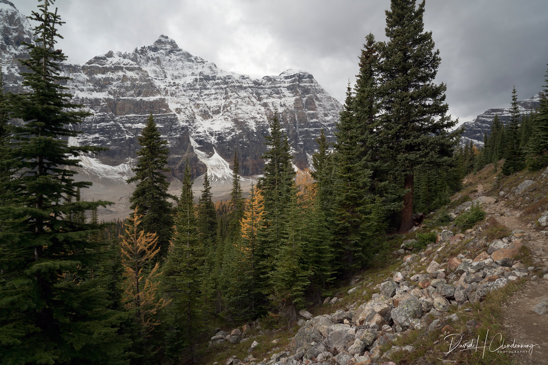
Title: Coming Storm, Larch Valley,
Order No.: L3-1117.
Location: Banff NP, Alberta
|

Title: Panorama View of Larch Valley, Alberta.
Order No.: L3-1129.
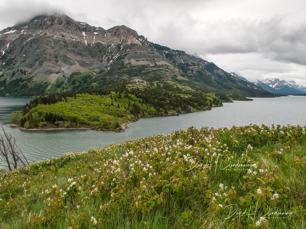
Title: Waterton Lake
Order No.: L3-9544.
Location: Near Prince of Wales Hotel, Waterton Lakes, AB.
|
Title: Origins of the Columbia River in Canada.
Order No.: L3-5198.
Location: British Columbia.
|
United States
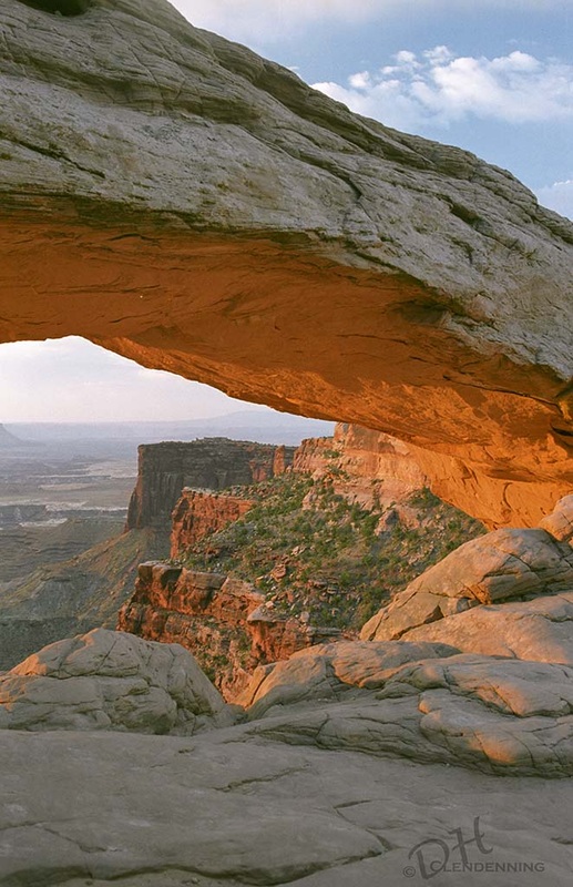
Title: Mesa Arch, Canyonlands.
Order No.: L3-0030.
Country: USA (Utah)
|
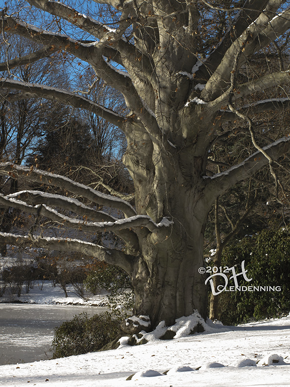
Title: Tree in Winter.
Order No.: L3-5948.
Location: USA (Mount Auburn, MA)
|

Title: Early Morning, Northwest Harbour.
Order No.: L3-7659.
Location: USA (Maine)
|
Title: Rushing Waters.
Order No.: L3-9268.
Location: USA (Glacier National Park, Colorado)
|
Title: Hamlin Quarry
Order No.:L3-7903
Location: South West Harbour, near Bar Harbour, Maine
|
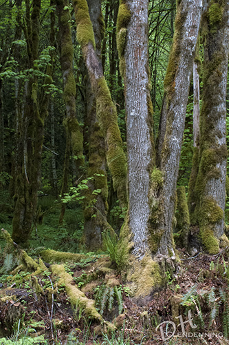
Title: Forest Floor.
Order No.: L3-8579.
Location: USA (Mount Ranier NP, Washington)
|

Title: California Hills.
Order No.: L3-9999.
Location: High Sierras

Title: El Capitan.
Order No.: L3-0091.
Location: Yosemite National Park, CA
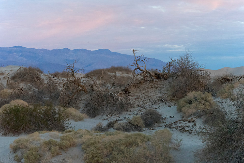
Title: Sunrise
Order No.: L3-2592.
Location: Death Valley, CA